Log in
All resources
Create a design
263 Free Artworks of 1750 Maps
maps in the library of congress
bibliothèque nationale de france
maps by tomas lopez
maps by claude joseph sauthier
claude joseph sauthier
richard william seale
maps by richard william seale
eran laor cartographic collection
emanuel bowen
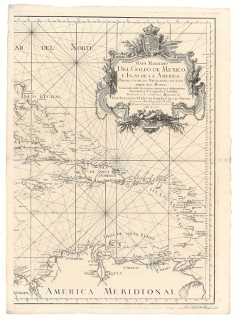
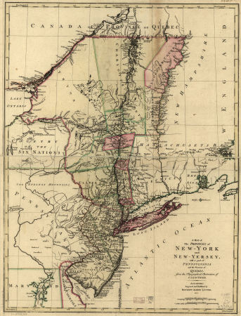
a map of the provinces of new york and new jersey, with a part of pennsylvania and the province of quebec
nieuwe en beknopte hand-atlas (1754)
old maps of the strait of gibraltar
the natural history of barbados (1750)
scotland district
maps in the library of congress
18th-century maps of martinique
fra mauro map derivative works
history of halifax, nova scotia
moses harris
iconografia della ducal basilica dell'evangelista s. marco
plans of st. mark's basilica (venice)
eran laor cartographic collection
emanuel bowen
a new & correct map of england and wales (foster)
1750s maps of england
1750s portrait paintings from ireland
thomas hickey
east prospect of the city of philadelphia
independence hall in art
maps in the rijksmuseum amsterdam
18th-century maps of japan
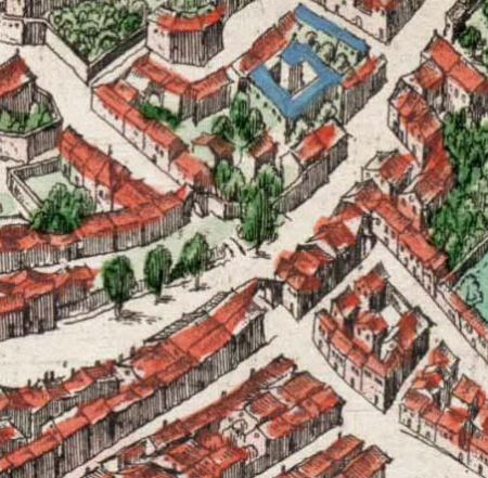
sixth map of paris from traité de la police
maps of paris from paris musées
maps by jakob van der schley
old maps of southeast asia
maps in the library of congress
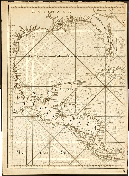
old maps of florida
maps in the library of congress
old maps of barbados
old maps of the moon
tobias mayer
1750s maps of saxony
old maps of leipzig
recueil d'antiquités égyptiennes, étrusques, greques et romaines (1752)
18th-century maps of paris
maps of paris by braun & hogenberg
maps in the british museum
jean-baptiste-henri delahaye
philippe buache
maps by jakob van der schley
1750s maps of taiwan
eran laor cartographic collection
emanuel bowen
eran laor cartographic collection
guillaume dheulland
maps in the library of congress
1758 maps
maps in the library of congress
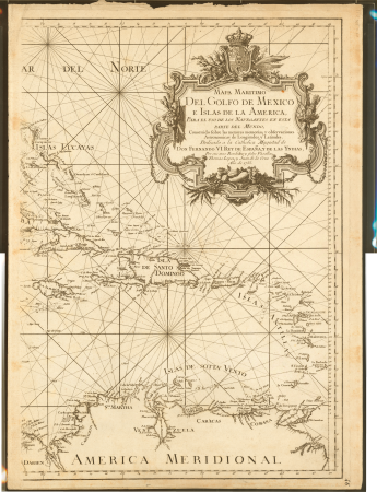
18th-century maps of jamaica
considérations géographiques et physiques sur les nouvelles découvertes au nord de la grande mer
1750s maps of the russian empire
maps in the library of congress
1780s maps of cuba
maps in the library of congress
cartouches by tomas lópez
maps in the library of congress
old maps of new jersey
eran laor cartographic collection
emanuel bowen
damascus in the 1750s
old maps of damascus
18th-century maps of new orleans
maps in the library of congress
maps in the library of congress
1780s maps of the caribbean
history of münster (westfalen)
1750s sieges
maps in the library of congress
1785 maps
maps in the library of congress
1768 maps of north america
eran laor cartographic collection
richard william seale
general plans of the park of versailles
paul prieur
maps in the library of congress
1758 maps of cuba
a map of the provinces of new york and new jersey, with a part of pennsylvania and the province of quebec
lawrence h. slaughter collection of english maps, charts, globes, books and atlases
heemstede, north holland
hendrik de leth
maps by petrus schenk
1750s maps of saxony
a map of the provinces of new york and new jersey, with a part of pennsylvania and the province of quebec
lawrence h. slaughter collection of english maps, charts, globes, books and atlases
a map of the provinces of new york and new jersey, with a part of pennsylvania and the province of quebec
lawrence h. slaughter collection of english maps, charts, globes, books and atlases
maps from university of amsterdam special collections
atlas der neederlanden
maps by jean-baptiste bourguignon d'anville
old maps of roman hispania
1750s maps of central america
maps by tomas lopez
history of university of amsterdam
old maps of amsterdam
maps in the library of congress
1773 maps of the united states
maps in the library of congress
1755 maps
a map of the provinces of new york and new jersey, with a part of pennsylvania and the province of quebec
maps in the library of congress
1750s maps of london
maps by isaak tirion
maps in the library of congress
1776 maps of new jersey
maps in the library of congress
1765 maps
maps in the library of congress
1776 maps of new jersey
maps in the library of congress
old maps of antigua and barbuda
old maps of oxfordshire
maps by thomas kitchin
bibliothèque nationale de france
maps by thomas kitchin
18th-century maps of cornwall
maps by thomas kitchin
bibliothèque nationale de france
maps by thomas kitchin
maps in the library of congress
1776 maps
maps in the library of congress
1750s maps of the americas
maps from university of amsterdam special collections
atlas der neederlanden
maps in the library of congress
1771 maps of north america
portrait paintings of joseph ii, holy roman emperor in military uniform
male portrait paintings by johann heinrich tischbein
juan de la cruz cano y olmedilla
maps by tomas lopez
juan de la cruz cano y olmedilla
maps by tomas lopez
maps in the library of congress
1777 maps of new york (state)
a map of the provinces of new york and new jersey, with a part of pennsylvania and the province of quebec
lawrence h. slaughter collection of english maps, charts, globes, books and atlases
maps in the library of congress
1771 maps of north america
eran laor cartographic collection
philippe de la rué
a map of the provinces of new york and new jersey, with a part of pennsylvania and the province of quebec
maps in the library of congress
maps by richard william seale
1740s maps of south america
1750s maps of the netherlands
18th-century maps of zeeland
recueil d'antiquités égyptiennes, étrusques, greques et romaines (1756)
18th-century maps of paris
maps in the library of congress
1776 maps
maps in the library of congress
1777 maps
maps in the library of congress
1771 maps of north america
maps in the library of congress
1755 maps of north america
carte de barbarie, nigritie, guinée par guillaume delisle (1707)
bibliothèque nationale de france
juan de la cruz cano y olmedilla
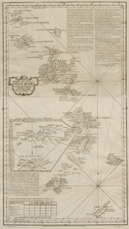
1750s maps of the caribbean
maps in the library of congress
1755 maps of north america
eran laor cartographic collection
willem albert bachiene
etchings in the rijksmuseum amsterdam
maps in the rijksmuseum amsterdam
avignon in the 17th century
atlas van loon
maps in the rijksmuseum amsterdam
18th-century maps of indonesia
maps in the library of congress
1753 maps
1750s maps of california
1705 maps of california
a map of the provinces of new york and new jersey, with a part of pennsylvania and the province of quebec
maps in the library of congress
general charte der in den herzoglich bremen - und verdenschen aemtern und gerichten ottersberg, osterholtz, lilienthal, bremervörde, rotenburg und achim belegenen mööre, und der seit 1750 darin... - btv1b531196435
bibliothèque nationale de france
prints by simon fokke in the rijksmuseum amsterdam
etchings in the rijksmuseum amsterdam
1750s maps of north america
solomon bolton
general charte der in den herzoglich bremen - und verdenschen aemtern und gerichten ottersberg, osterholtz, lilienthal, bremervörde, rotenburg und achim belegenen mööre, und der seit 1750 darin... - btv1b531196435
bibliothèque nationale de france
general charte der in den herzoglich bremen - und verdenschen aemtern und gerichten ottersberg, osterholtz, lilienthal, bremervörde, rotenburg und achim belegenen mööre, und der seit 1750 darin... - btv1b531196435
bibliothèque nationale de france
general charte der in den herzoglich bremen - und verdenschen aemtern und gerichten ottersberg, osterholtz, lilienthal, bremervörde, rotenburg und achim belegenen mööre, und der seit 1750 darin... - btv1b531196435
bibliothèque nationale de france
maps in the library of congress
1776 maps of new york (state)
maps in the library of congress
1776 maps of new jersey
istanbul in the 1750s
maps by john rocque
okumura masanobu
hashira-e,uki-e
maps in the rijksmuseum amsterdam
maps by isaak tirion
101 - 200 of 263
Next page
/ 3


![Sixth plan of the city / of Paris / And its increases, from the beginning of the Reign of Charles / VII, the year 1422, until the end of the Reign of Henry III, the year 1589 [1705], Antoine Coquart](https://cdn.creazilla.com/illustrations/10000442243/sixth-plan-of-the-city-of-paris-and-its-increases-from-the-beginning-of-the-reign-of-charles-vii-the-year-1422-until-the-end-of-the-reign-of-henry-iii-the-year-1589-1705-antoine-coquart-md.jpg)


![Lutetia vulgari nomine Paris [...], 1630-1750 (circa)](https://cdn.creazilla.com/illustrations/10000472156/lutetia-vulgari-nomine-paris-1630-1750-circa-sm.webp)